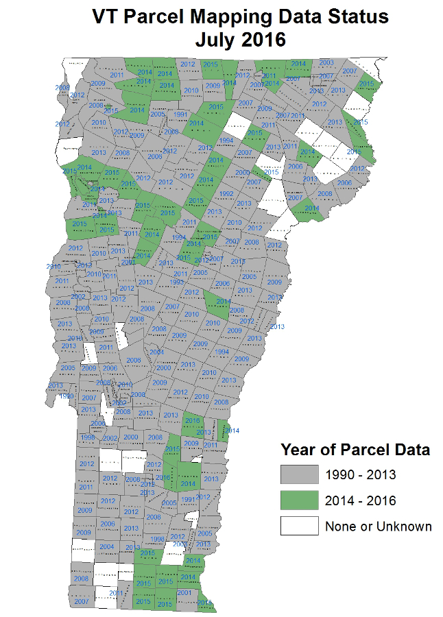
 During the 2016 legislative session, Vermont lawmakers passed a Transportation Bill that will develop the Vermont Statewide Property Parcel Mapping Program. The Vermont Agency of Transportation is providing funding for the project, which will create a statewide, consistent, and up-to-date GIS database of parcel boundaries. The ongoing program will help to ensure that the data created is updated annually and made available to the public.
For more information about the program, click here.
Download Visualizing Land Ownership Across Vermont
Those interested in learning more can also attend these upcoming meetings:
- Parcel Data Standard Update focus group, August 24 in Montpelier – Learn more
- VT Assessors and Listers Association Annual Meeting, September 19 in Fairlee
- VLCT Town Fair, October 6 in Essex
- Meetings and Brown Bag Lunch events at Regional Planning Commissions – To Be Scheduled.